Lens-Artists #89: A River Runs Through It

Amy at Lens-Artists has as her theme for this week’s challenge: river.

Starting out close to home, here is the Des Plaines River during a November walk on the Des Plaines River Trail. This is a very pretty stretch of the slow-moving river, but it is responsible for many floods in the cities along its banks due to heavy rain.
20171103_143328
The Des Plaines River, which gave the suburban city that was my home for over 30 years its name, flows 133 miles southward from southern Wisconsin to south of Joliet, Illinois, where it joins the Kankakee River and becomes part of the Illinois River. Contrary to popular opinion, Des Plaines, a French name, does not mean “of the plains.” It actually refers to either the sycamore or the maple tree, which resembles the European plane tree, and was named by French traders in the 18th century.

The Chicago River is prominently featured in many photos of downtown Chicago and can be viewed from any of the bridges on  main thoroughfares of the city. This photo was taken at Michigan and Wacker near the site of the original Fort Dearborn.
20181030_134752
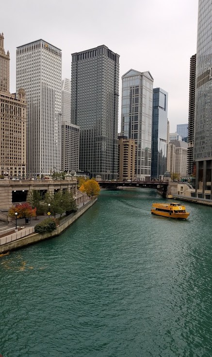
Chicago celebrates its river by dying it Kelly green every St. Patrick’s Day (although they didn’t do that this year – celebrations were canceled due to the coronavirus pandemic), by constructing a pleasant river walk lined with eateries, which is still under construction, and opening a River Museum that tells the story of the Chicago River and offers nice views of the river from its windows. The river is most famous for an engineering feat undertaken at the turn of the 20th century: the main stem of the river’s flow was reversed so that it now flows out of Lake Michigan, through a system of locks. This increased the volume of the river, which now empties into the Chicago Sanitary and Ship Canal.

The Colorado River is the most iconic and important river in southwestern United States. It is responsible for carving some of the most beautiful scenery of the west, including the Grand Canyon and others preserved in 11 national parks. This photo was  taken at the Grand Canyon and is strangely the only photo I have of the river!
20151220_122709
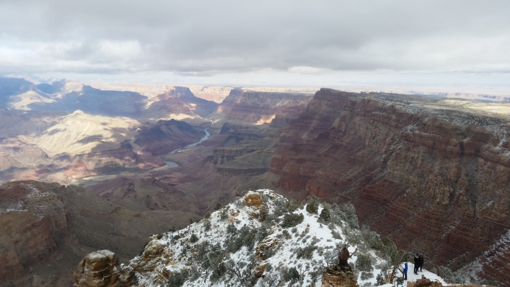
The Colorado River starts in the Rocky Mountains of Colorado and meanders southward 1,450 miles to the Gulf of California. The river and its tributaries provide water for 40 million people in the Southwest. Native Americans have occupied the Colorado Basin for at least 8,000 years and the culture of the region is strongly influenced by their presence. The Desert View Watchtower, from where the above photo was taken, was designed by Mary Colter who took inspiration from the native peoples that inhabited and continue to dwell in the region. Below is the Watchtower from the inside and outside.


No tour of American rivers would be complete without the Mighty Mississippi! Below are two photos of the river just north of St. Louis on the Illinois side of the border. It was nearly sunset when we got to this spot.
20180615_194649
A view of a couple of the bridges across the Mississippi at that spot
SONY DSC
Flowing southward 2,320 miles from its origin near Lake Itasca, Minnesota, it is the second longest river in North America. With its many tributaries, the Mississippi watershed drains 32 American states and 2 Canadian provinces. Native Americans have lived along this river for thousands of years, including the mound builders who are now thought to have been one of the major ancient civilizations in the Americas. The region along which it passes is very fertile and it is now a common riverboat cruise vacation, inspired by the steamboats that have plied its waters for the last two centuries, as well as other riverboats carrying cargo, animals and people as a main form of transportation.

Jumping to another continent, Africa is home to the longest river in the world, the Nile. The Nile was at the center of the ancient Egyptian civilization, which grew up along its banks where the land was fertile. The ancient Egyptians depended on its annual inundation, which no longer occurs due to dams, especially the High Dam of Aswan.
20181229_090351d
Sunset on the Nile:
DSC_0275
Fishermen on the Nile

The Nile originates south of the equator and flows northward 4,132 miles to empty into the Mediterranean Sea. The ancient Egyptians called the river Ar or Aur, meaning “black” due to the color of the mud created by the sediments when it was flooded. Because of the direction of flow from south to north, the ancient Egyptians referred to their southern territory as “Upper Egypt” and the northern territory and the Delta “Lower Egypt.”

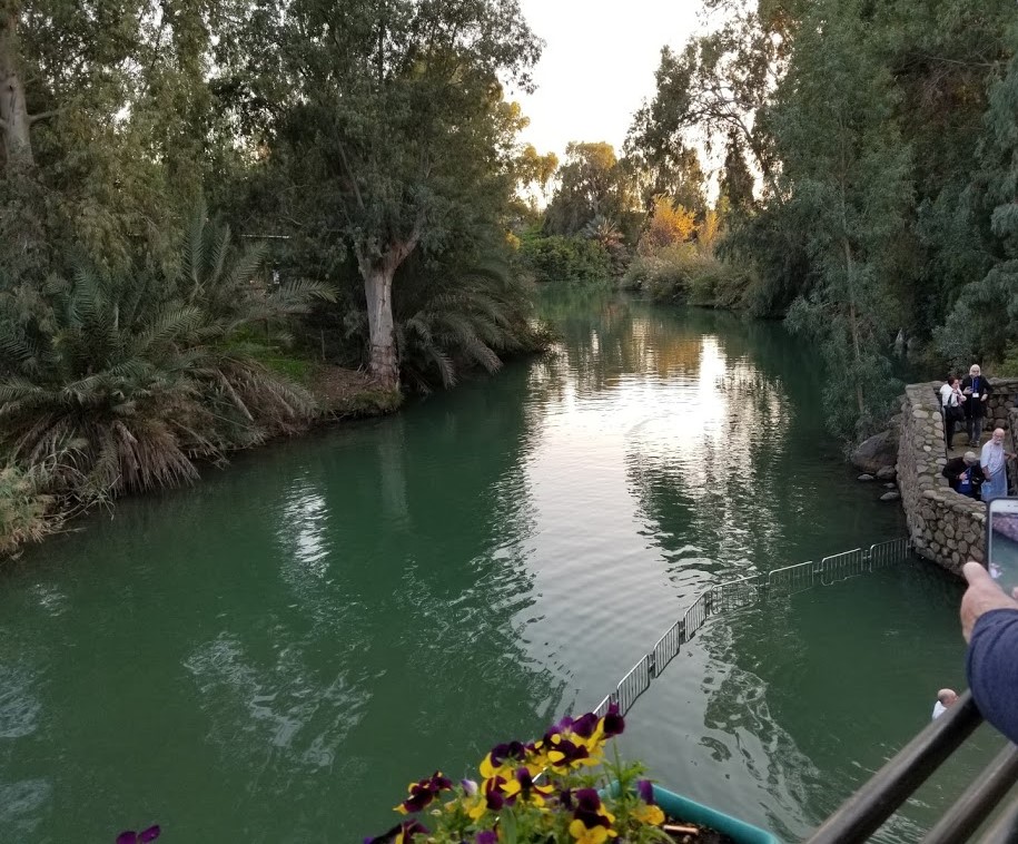
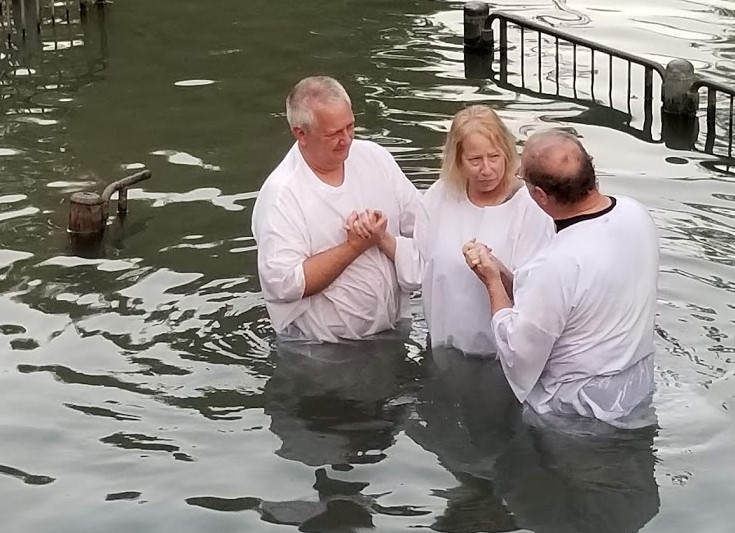
The most famous river in the Bible is the Jordan River. Many songs and prayers refer to it and today many pilgrims go to the river to be baptized.
20190110_161744d
A friend about to be baptized at Yardenit Baptismal Center
20190110_163541d
The Jordan River connects the Sea of Galilee and the Dead Sea. 156 miles long, it runs north to south along the border between Jordan, the Palestinian West Bank, Israel and Southwestern Syria.

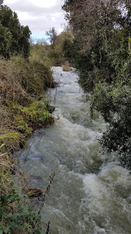
Another river in Israel is the Dan. The Dan River originates in Israel and is the largest of the three principal tributaries of the Jordan River. The Dan River flows from Tel Dan, the site of the biblical city of Dan (Laish). The river is fed by the rains and snowmelt that pass through the rock of Mount Hermon and emerge at its foot to form hundreds of springs.
20190109_113953
The Tel Dan Nature Reserve has hiking trails and encompasses the ruins of Tel Dan.

Last summer we took a river cruise in Europe, on the Rhine, Main and Danube Rivers.
Cruises on the Rhine River are popular, because one can view a series of medieval castles rising on the hills along its banks, as well as sample a variety of wines grown in its vineyards that cover the hillsides. This photo was taken from Marksburg Castle in Germany.
20190628_105044
Wine growing and castles are beautiful scenery on the Rhine.

The Rhine is the second longest river in central/west Europe, about 760 miles (1,230 km) long. It originates in the Swiss Alps and flows north to empty into the North Sea. The Rhine and Danube rivers comprised most of the northern inland frontier of the Roman Empire.

Through a series of locks, a river cruise travels from the Rhine into the Main River and then into the Danube. The Main River is located entirely within Germany.
20190629_173751
We went through a series of locks.

The Main River is 326 miles (525 km) long, the longest tributary of the Rhine. Major cities along the Main include Frankfurt and Würzburg.

The Danube River is the second longest river in Europe (longest is the Volga) and flows through 10 countries, more than any other river in the world.
20190705_142245DSC01947
The Danube, called Donau in German, flows 1,770 miles (2,580 km) southeast, originating in the Black Forest of Germany and emptying into the Black Sea. Four national capitals are located along the river: Vienna, Bratislava, Budapest, and Belgrade.

A tributary of the Danube is the Inn River which flows through Switzerland, Austria and southern Germany.
DSC01803
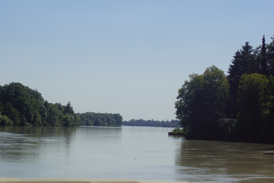
Ducks on the Inn River at Schärding, Austria
20190704_162436
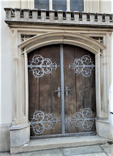
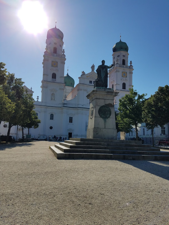
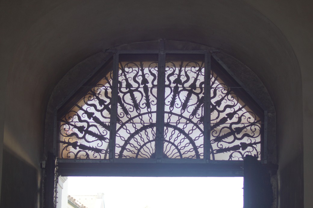
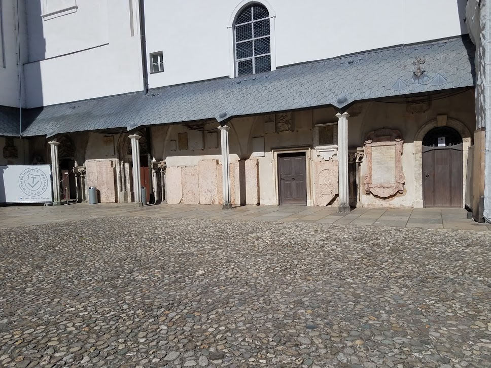
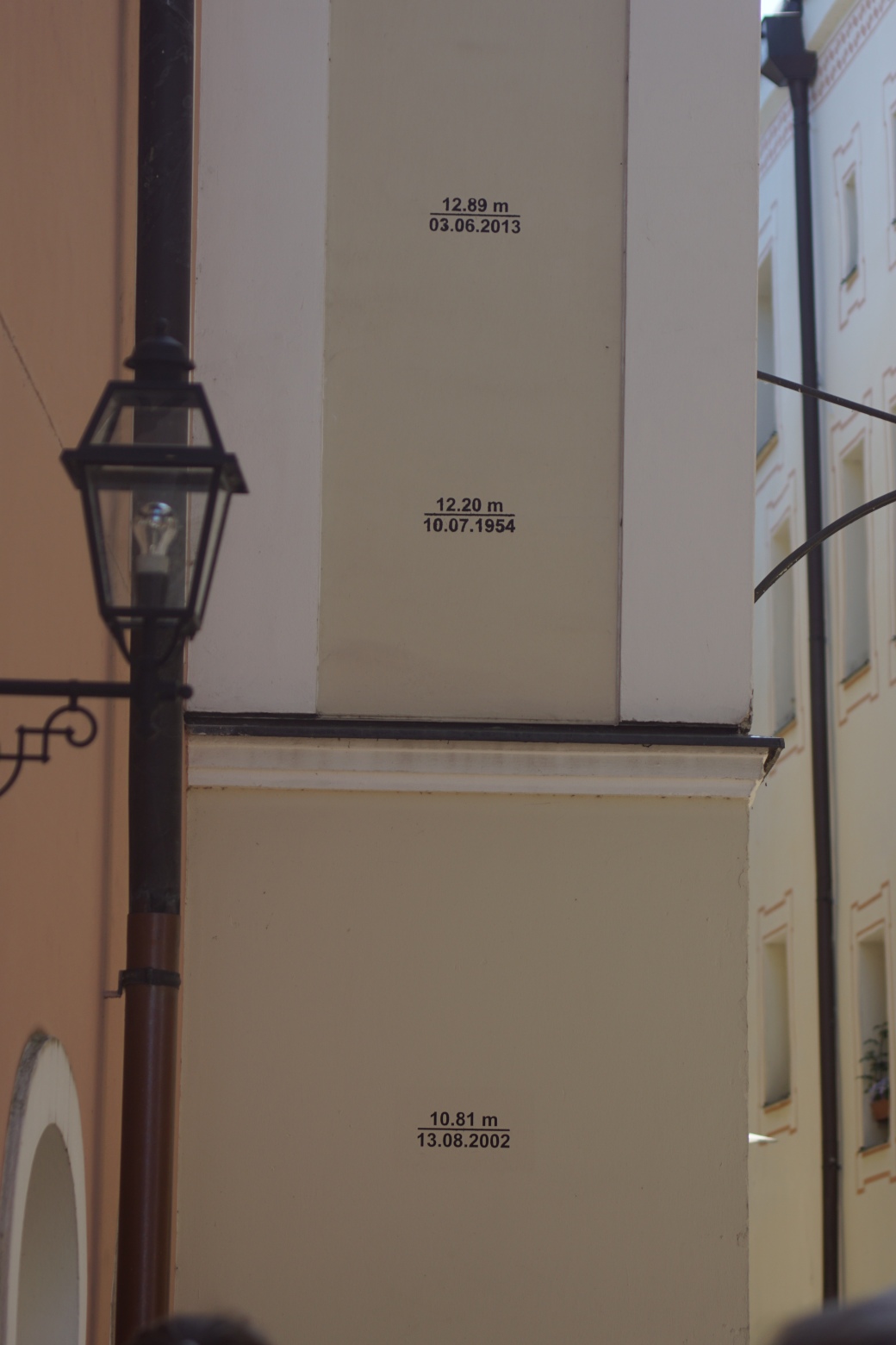
The Inn is 322 miles (518 km) long and forms part of the Austria-Germany border at Passau. There is a coin-sized marker on this bridge, indicating the border: on the left is Germany, on the right is Austria.
20190704_154302


Thursday Doors/FOTD: Schoenbrunn Palace

July 7, 2019

On our second day in Vienna (and 2nd to last day of our Grand European Tour cruise!), we visited Schönbrunn Palace. This 1,441-room palace was the summer residence of the Habsburg rulers and is a major tourist attraction in Vienna. The palace in its current form was built in the 1740s-1750s during the reign of empress Maria Theresa who received the estate as a wedding present. Her husband, Franz, had the exterior of the palace redecorated in neoclassical style as it is today.

The only female Habsburg ruler, Maria Theresa ruled for 40 years. She and Francis (Franz) I, the Holy Roman Emperor, had sixteen (!) children – eleven daughters, including the Queens of France and Naples, and five sons, two of which were Holy Roman Emperors. Thirteen of her children survived infancy. There is a portrait of her in the palace and when it was pointed out to us, the guide told us the story of Austria’s female empress. We gasped when she told us the empress had 16 children!

The longest reigning emperor of the Austrian-Hungarian Empire, Franz Joseph I, was born at Schönbrunn Palace in 1830 and spent much of his life there. He reigned from the end of 1848 until his death in 1916. The end of World War I saw the fall of the Habsburg empire so the palace was given to the Austrian Republic and preserved as a museum.

As with all the palaces we visited in Europe, photography was not allowed inside, so all my photos are of the palace’s exterior and its extensive gardens.

Being able to take pictures on the outside, I managed to photograph several doors and gates for today’s Thursday Doors challenge!

20190707_101531

The ornate entrance gate

DSC02031

Another “gate” or archway, within the gardens

20190707_111503

DSC02023

Balcony shuttered door

DSC02025

This one is my favorite!

20190707_114433

More doors with shutters

20190707_115120
20190707_111415
For a fee, one can take a horse and carriage ride. I was intrigued by the horses’ “hats”!
20190707_111019Schönbrunn Palace and its gardens were recognized by the UNESCO World Heritage Foundation in 1996 as a remarkable Baroque estate. Many beautiful white marble statues flank its gardens; I posted a few of these a couple of weeks ago for Sculpture Saturday.

20190707_115342
Wait…this guy isn’t a real statue, although he remains motionless until you get close! Perhaps he can sing a few bars of a Mozart symphony!

In spite of the summer crowds and the heat of the day, I enjoyed our visit to this former summer home of the Habsburgs. Here’s a vase of flowers for Cee’s FOTD 2/13/20.
DSC02030
Historical information from my personal notes and Wikipedia: Schönbrunn Palace.


Melk Abbey and Town

July  5, 2019

Today we docked at Melk, a town on the Danube known for its abbey, which sits on a cliff overlooking the town. A bus drove us up the hill to tour the abbey.

The Benedictine abbey was founded in 1089. A monastic school was established in the 12th century and the library soon became renowned for its extensive collection of manuscripts.

The Baroque abbey seen today was built between 1702 and 1736. Particularly noteworthy are the frescoes painted by Austrian artist Johann Michael Rottmayr and the medieval manuscript collection which includes a famous collection of music manuscripts.
20190705_093156 
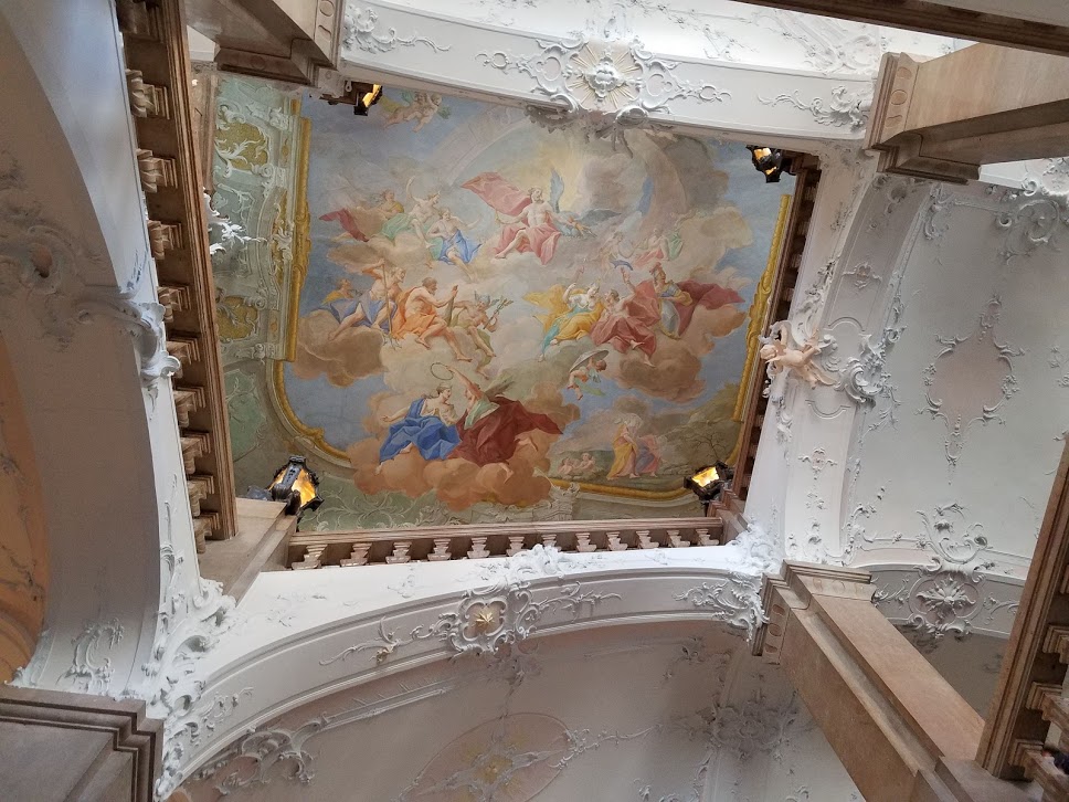
Frescoes in the library were painted by Paul Troger, distinguished by their pastel colors and dramatic sense of movement. We could not take photos inside the abbey but I took many of the exterior, with its views of the town and beautiful gardens.
20190705_093246
DSC01850


DSC01869
The abbey managed to escape a series of threats, such as dissolution under Emperor Joseph II when many other abbeys were seized and dissolved between 1780 and 1790, because of its fame and academic stature; and during the Napoleonic Wars. When Austria was incorporated into Nazi Germany in 1938, the school and a large part of the abbey were taken over by the state.

The school was returned to the jurisdiction of the abbey after World War II and it continues in operation to this day, with an enrollment of 900 students of both genders.

Melk Abbey has been mentioned or featured in several works of literature and films.

20190705_105753

Bad Ischl clock (c. 1810), made entirely from 10 kinds of wood, including pear, walnut, beech, linder, maple, ash, oak, Scotch pine, larch, and European spindle tree. After repairs in 1970, some metal parts were installed, such as the middle spring and middle bar.

Entryways (aka doorways)…

Looking down on the entrance to the abbey…

Views from the upper patio of the abbey20190705_103346DSC01848DSC01862DSC01865DSC01866DSC01870
Scattered around the gardens were whimsical sculptures of animals.

DSC01879DSC0188220190705_111140

Abbey mascot? I found this friendly Manx cat just chillin’ in the front courtyard of the abbey. She didn’t appear at all fazed by the crowds of tourists. I speculated that her home was one of the houses that are located on the hill just below the abbey.
DSC01880
By the time I saw this cat, I had determined to walk back to the ship – it was all downhill and I could use the exercise. Dale didn’t want to walk, however, so I left him to take the bus back.

I was looking forward to taking a lot of photos of the town, which I did, but in the end, I got lost and ended up having to ask for directions and backtrack to get back to the ship.

On my way downhill, meanwhile, I saw restaurants and small patios wedged between houses on the hillside.
20190705_11325120190705_113241
DSC01885
As I descended, I passed through the main commercial area, lined with restaurants and tourist shops. And one shop that sold lederhosen!
20190705_113509
20190705_113851
20190705_11362020190705_113556
And there were a few interesting doors, to satisfy Norm’s Thursday Doors aficionados…
20190705_111401
20190705_11371320190705_114111
20190705_113841
Flower-decorated balconies…
20190705_113959
20190705_114048
Sculptures and installations…
20190705_114348

20190705_114442

The Tower of Babel at the Sommerspiele Melk, made of approximately 30,000 Bioblo building blocks.

Close-up of Bioblo blocks (including Bioblo doors! 😉 )
20190705_114512
Finally, I reached the bar/restaurant/souvenir shop where we had gathered to get on the bus at the beginning of the tour. (When I saw it, I remembered it…”Oh, yeah!!”)
20190705_091441
From behind this building, it was a short hike along the river dock back to the ship! What a relief!

Landscapes Around the World

Nancy’s A Photo A Week challenge this week features landscapes.

These are some landscapes from my travels, and closer to home.

July in Austria – scene looking down from Melk Abbey, where the Inn and Danube Rivers meet.
DSC01870
Austria – cruising the Inn River near Schärding
20190705_142245
June at Kinderdijk, Netherlands
20190626_084816
February in Ngorongoro Crater, Tanzania
SONY DSC
Mount Kilimanjaro – on a flight from the Serengeti to Arusha, Tanzania
SONY DSC
Des Plaines, Illinois on a snowy February day
20180218_214406
June at Devil’s Elbow Bridge, Missouri
SONY DSC
June at the Painted Desert, Arizona
SONY DSC
May at Rocky Mountain National Park, Colorado
20180531_16181420180531_162757
June in Arches National Park, Utah
20180603_131433
December along the Nile River near Luxor, Egypt
20181228_095739

Lens-Artists Photo Challenge: Leading Lines

Lens-Artists Photo Challenge #80 is about leading lines. Leading lines are one of the “rules” of composition: There are indeed “rules” of photographic composition, which like many other rules, are made to be broken. Whatever their skill level or experience though, understanding and knowing when to use the “rules” of composition can be helpful for any photographer. This week, our challenge will explore a key compositional element, Leading Lines. …Leading lines carry our eye through a photograph. They help to tell a story, to place emphasis, and to draw a connection between objects. They create a visual journey from one part of an image to another and can be helpful for creating depth as well.

This is how I spent the last two Junes, 2018 and 2019.

Our road trip (mostly) on Route 66: Sedona and Winslow, AZ
20180610_113200
20180610_132146
20180610_140539
We visited the Painted Desert, too: first, horizontal lines.
SONY DSC
Undulating formations which slope downward.
SONY DSC
In Santa Fe, colorful pillars…
20180611_191904
and a souvenir shop with paintings lined up along a counter.DSC_0626
When on Route 66, here’s a sight not to miss: Cadillac Ranch. It had rained the night before.

A year later, we were on a river cruise in Europe. One of the first ports of call was Cologne, Germany with its famed cathedral, with stained glass windows reaching toward heaven…
20190627_110629
…and soaring arches decorated with sculptures of saints.
DSC00896
Later we crossed the bridge to return to our ship. The inner side of the bridge is covered with “love locks” – padlocks people leave in honor of their sweethearts. They stretch on as far as the eye can see!
20190627_123240
Next stop was Marksburg Castle, which afforded beautiful views of the Rhein River and town below (I wish I could photoshop that pole out, but I don’t have the software).
DSC00997
And here’s a different view: a steeple rises up as seen through a turret.
DSC00990
Marksburg is definitely a “must” on any Rhine River cruise. It’s like a fairy tale castle!
DSC01013
Farther on down the river, a swan swam over near our ship.
DSC01277
We were passing through a lowland area.
20190629_121114
I loved the small town of Miltenberg, which was so picturesque!
DSC01343
Inside a church, hymnals were stacked neatly in the narthex. One is drawn to the word Gotteslob, which perhaps means hymnal.
DSC01324
Our final stop on the cruise was Budapest, Hungary. A memorable part of the day we were there was a walking tour through the old Jewish Quarter.
DSC02286


Thursday Doors: A Walk Through Schärding, Austria

On the 4th of July, the day we spent the morning in Passau, Germany, we opted for an afternoon tour to the small town of Schärding, Austria (population approx. 5,000). Passau and Schärding are essentially border towns.  We even crossed a bridge on the Inn River that had a small metal plaque in the middle with D (Deutschland – Germany) on one side and Ö (Österreich – Austria) on the other!
20190704_154302
The town of Schärding is a major port on the Inn River which is the dividing line between Bavaria in Germany and the Austrian state of Upper Austria.

The Bavarian family Wittelsbach owned the town until 1779. In the Middle Ages, due to its location, Schärding became a center of trade, particularly for salt, timber, ores, wine, silk, glass, grain, textiles and livestock. Originally the town was fortified; sections of the wall remain, but the castle that was originally there is no longer.

Schärding’s most beautiful feature is its central square with its rows of colorful, gabled buildings. The buildings are color coded so that illiterate people in past centuries would know what the building was used for. For example, the town hall (Rathaus) was yellow, and pharmacies were green. Nowadays, next to the Rathaus, the green building is a charming hotel, Hotel Stiegenwirt.

20190704_16081020190704_160924

The town’s skyline is dominated by St. George Church. It is Roman Catholic; more than 80% of the town’s residents identify themselves as Roman Catholic.

When I was not attending a workshop to make herbal salt (I ended up not keeping it – the salt content was way too high for me!), I joined Dale to explore the streets of the town.
20190704_162813
DSC01837
DSC01827DSC01826
Two interesting clocks!
DSC01836DSC01842 (2)
Schärding’s coat of arms is painted on the side of a building.
DSC01825
Historically, Schärding’s population suffered an epidemic of the plague. A plague pole was erected when the epidemic was over, to thank the Virgin Mary for saving people from the plague.
20190704_160408
There is a statue to St. Christopher, the patron saint of travelers, in the center of a fountain. The fountain is hard to see in this photo because it was surrounded by construction zone fences.
DSC01824
Looking out toward the river from Durchgang Wasstertor.
DSC01832
I don’t know what these masks were for, but they look like instruments of torture!
DSC01833
There was also this display of possibly religious relics, near St. George Church.
20190704_165916
And now…Schärding doors!
DSC01830DSC0182920190704_16560720190704_161923

DSC01835
Posted for Norm’s Thursday Doors 1/16/20.

Some historical information obtained from Wikipedia’s article on Schärding.

Thursday Doors: Passau Walking Tour

The German city of Passau is located in Bavaria very close to the Austrian border, at the confluence of three rivers: The Danube, the Inn and the Itz. It was the last German city we stopped at during our cruise last June-July. We arrived at Passau on the U.S. Independence Day, July 4.  This post is my contribution to Norm’s Thursday Doors 12/12/19.
20190704_084052
Passau has a population of about 50,000, of which 12,000 are students at the local university. A devastating fire in 1662 destroyed most of the city, which was rebuilt in Baroque style.
20190704_084054

DSC01716.JPG
20190704_08554520190704_085624
20190704_085714.jpg
20190704_090035.jpg
Passau is known for its cathedral, St. Stephan, which has five organs! One of the organs is in the attic and the five can all be played at the same time.  The organ(s) has 17,774 pipes and 233 registers, and it is the 2nd largest pipe organ in the world. We attended a concert showcasing this amazing sound after our walking tour. Concerts are held daily between May and September.

20190704_090420

In this square behind St. Stephan Cathedral is a statue of Maximilian I, the first king after Napoleon.

20190704_100250.jpg
A cathedral door and details20190704_09093920190704_091011
DSC01782

DSC01734

Same door from the inside

Baroque décor characterizes the interior of St. Stephan.
20190704_091039

20190704_091413

The main organ is in the traditional place in the back of the cathedral.

20190704_091505

The priest used to say mass from this golden pulpit, but now stands behind a podium adorned with the eagle of St. John (photo below).

DSC01733

20190704_091516

DSC01771
We went out into a courtyard beside the cathedral.
20190704_092036
In the courtyard are some extra panels and artifacts from the church.
20190704_092216

DSC01737

This angel head fell off during a fire in the church. It gives a perspective of the true size of the sculptures in the church.

We continued downhill from the church on the cobblestone streets of Old Town.
20190704_092552
20190704_092620
20190704_092643
20190704_09270020190704_09271320190704_092728
The city has been plagued by floods for centuries, due to its location at the junction of three rivers. On June 2, 2013, the old town suffered a severe flooding after it had rained for several days. The photo below shows how a street of Old Town looked on June 3.

20190704_092831.jpg
Peak elevation of floods as far back as 1501 are displayed on the wall of the Old City Hall.DSC01738

20190704_093131.jpg

This glass door is for 16 and 18 Hell Alley! The narrow street gets its name from its proximity to the river.

20190704_093257.jpg

Looking down Hell Alley, also known as Artists’ Alley, which is lined with small shops and cafes. 

20190704_093630
Hotel Wilder Mann
20190704_093838

20190704_09385220190704_09503420190704_095223
This pharmacy is one of the oldest in Passau. It is painted green, which was the “code” color for pharmacies in times when many people were illiterate.
20190704_095243.jpg
The Dom Museum entrance – this museum displays artifacts, relics and history of St. Stephan Cathedral.

20190704_095743

This door at the former bishop’s palace was deliberately built above the ground. It now belongs to the Dom Museum.

20190704_095850
Baroque architectural details adorn the ceiling of the palace.
20190704_095903
20190704_095933
20190704_100058
20190704_10045620190704_10262320190704_102847
20190704_103047.jpg
Passau has a Daschsund Museum! These sculptures are outside the entrance.

20190704_10321520190704_10323020190704_10324820190704_103327
“Coffee and love are best hot!”
20190704_103351
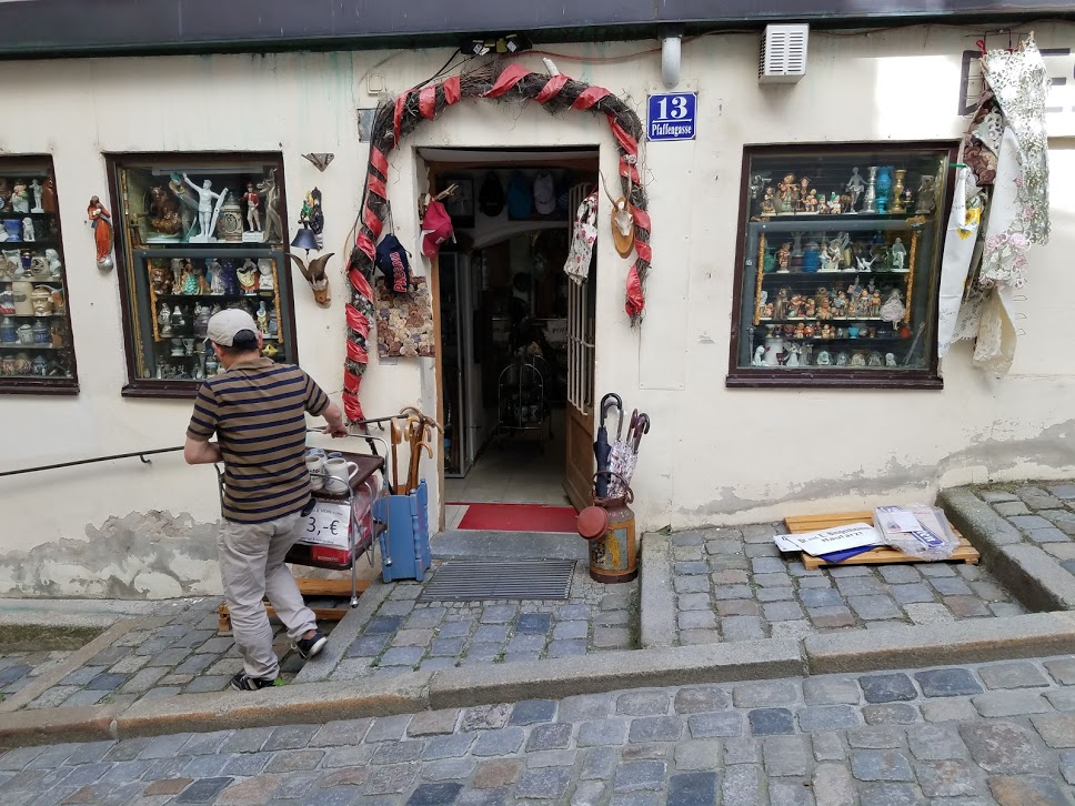
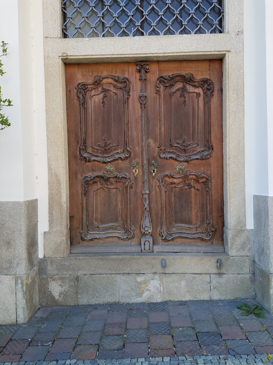
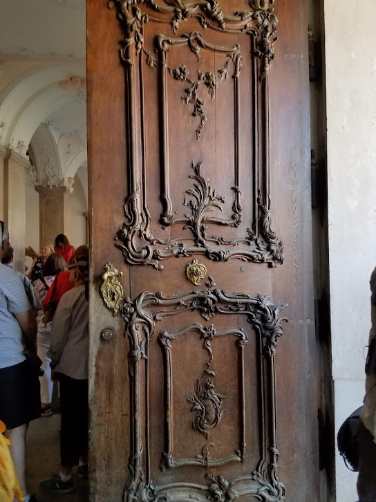
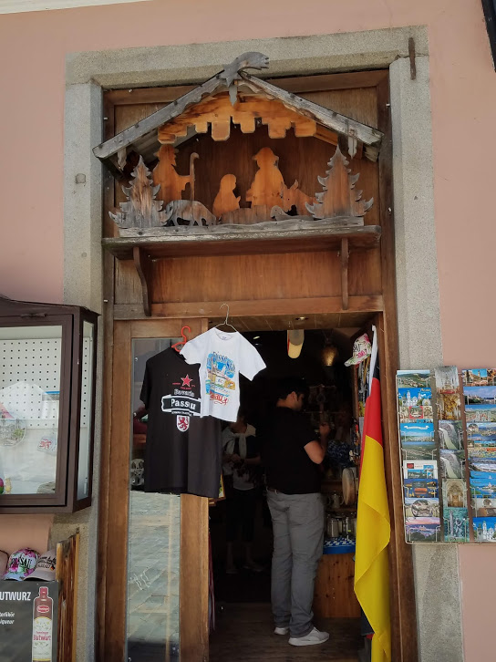
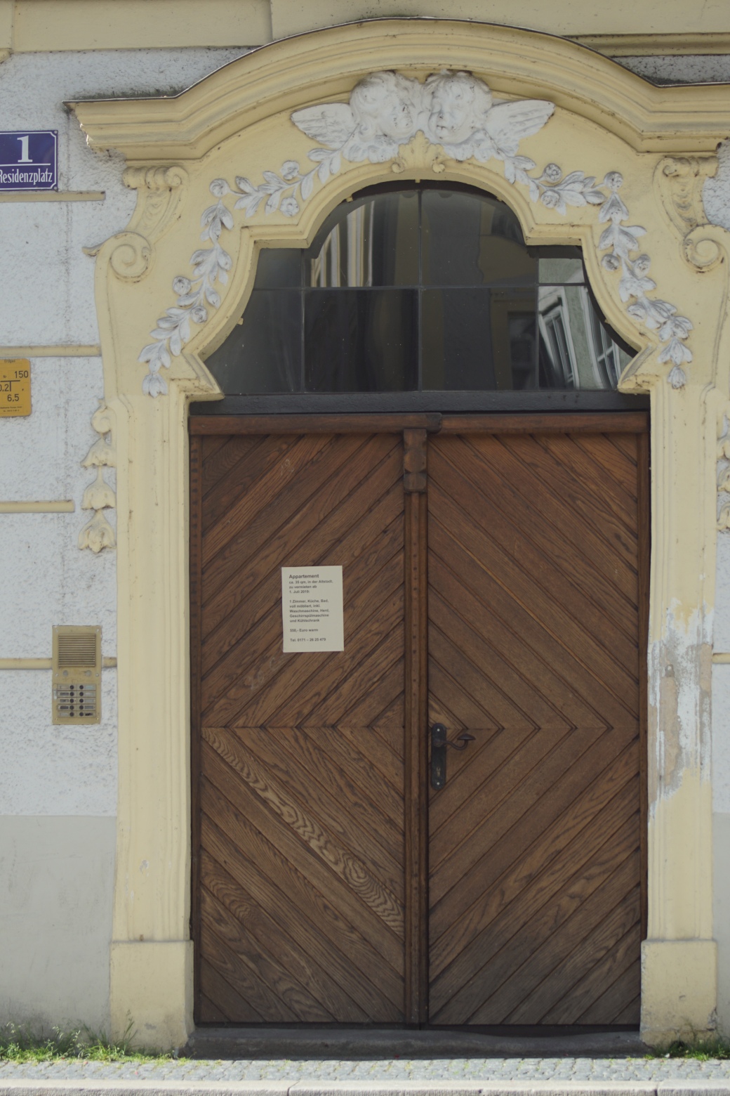
I found interesting that this shop door has a nativity scene above it.
20190704_103926
20190704_11412520190704_114221
DSC01717
The sign on this Baroque decorated door advertises a one-bedroom apartment within.
DSC01748

DSC01746

Religious statues high up on exterior walls of Old Town are seen commonly in towns throughout Bavaria.

Prominent above the city is Veste Oberhaus, a fortress founded in 1219.
DSC01744

Information for this post obtained from:
author’s notes
Wikipedia article Passau
TripAdvisor The Höllgasse